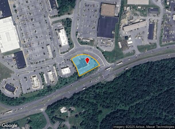
Property Record
121 Gateway Dr, Winchester, VA 22603

NEARBY LISTINGS FOR SALE OR LEASE
Property Detail
121 Gateway Dr
54A-99J
5
Multipleuses
.92 ACRES
X
Frederick
51069C0217E
Virginia
2025
0.92 AC
2025
Frederick County
051102
Washington, DC
4,054 SF
Winchester, VA-WV
DEMOGRAPHICS near 121 Gateway Dr
1 Mile
3 Mile
5 Mile
2024 Total Population
11,288
47,691
69,016
2029 Population
12,211
50,434
73,034
Pop Growth 2024-2029
+ 8.18%
+ 5.75%
+ 5.82%
Average Age
37
39
40
2024 Total Households
3,911
17,505
26,193
HH Growth 2024-2029
+ 8.13%
+ 5.40%
+ 5.48%
Median Household Inc
$62,735
$72,147
$72,251
Avg Household Size
2.70
2.60
2.50
2024 Avg HH Vehicles
2.00
2.00
2.00
Median Home Value
$216,889
$291,857
$309,366
Median Year Built
1985
1983
1986
Nearby Places
- Restaurants
- Banks
- Shops
- Fitness
- Groceries
SALE & LEASE HISTORY
LISTING DATE
SALE/LEASE

Feb 09, 2017
For Lease
Nearby Properties
Address
Land Use
TOTAL SIZE
Lot Size
Zoning
Address
Land Use
TOTAL SIZE
Lot Size
Zoning
64.27 AC
M1
Address
Land Use
TOTAL SIZE
Lot Size
Zoning
31,710 SF
47.28 AC
HE1
Address
Land Use
TOTAL SIZE
Lot Size
Zoning
79,038 SF
128.48 AC
RA
Address
Land Use
TOTAL SIZE
Lot Size
Zoning
56.15 AC
RA
Address
Land Use
TOTAL SIZE
Lot Size
Zoning
40,820 SF
31.78 AC
M1
Address
Land Use
TOTAL SIZE
Lot Size
Zoning
465,856 SF
43.50 AC
M1
Address
Land Use
TOTAL SIZE
Lot Size
Zoning
161,923 SF
17.10 AC
M1
Address
Land Use
TOTAL SIZE
Lot Size
Zoning
331,925 SF
21.17 AC
M1
Address
Land Use
TOTAL SIZE
Lot Size
Zoning
191,138 SF
35 AC
EIP
Address
Land Use
TOTAL SIZE
Lot Size
Zoning
348,500 SF
26.40 AC
M1
Address
Land Use
TOTAL SIZE
Lot Size
Zoning
462,500 SF
53.51 AC
B2
Address
Land Use
TOTAL SIZE
Lot Size
Zoning
100,465 SF
15.24 AC
RP
Address
Land Use
TOTAL SIZE
Lot Size
Zoning
423,360 SF
24.23 AC
M1
Address
Land Use
TOTAL SIZE
Lot Size
Zoning
287,000 SF
19.29 AC
M1
Address
Land Use
TOTAL SIZE
Lot Size
Zoning
27,464 SF
8.53 AC
B2
Address
Land Use
TOTAL SIZE
Lot Size
Zoning
325,000 SF
18.09 AC
M1
Address
Land Use
TOTAL SIZE
Lot Size
Zoning
300,000 SF
29.04 AC
M1
Address
Land Use
TOTAL SIZE
Lot Size
Zoning
181,832 SF
17.96 AC
CM1
Address
Land Use
TOTAL SIZE
Lot Size
Zoning
65,320 SF
2.62 AC
B1
Address
Land Use
TOTAL SIZE
Lot Size
Zoning
347,200 SF
25.50 AC
M1
Address
Land Use
TOTAL SIZE
Lot Size
Zoning
153,024 SF
33.47 AC
EIP
Address
Land Use
TOTAL SIZE
Lot Size
Zoning
64,711 SF
18.10 AC
B2
Address
Land Use
TOTAL SIZE
Lot Size
Zoning
56,746 SF
30 AC
M1
Address
Land Use
TOTAL SIZE
Lot Size
Zoning
84,375 SF
20 AC
R4
Address
Land Use
TOTAL SIZE
Lot Size
Zoning
80,744 SF
21.41 AC
B2
Address
Land Use
TOTAL SIZE
Lot Size
Zoning
5,293 SF
195.07 AC
LR
Address
Land Use
TOTAL SIZE
Lot Size
Zoning
257,491 SF
24.40 AC
M1
Address
Land Use
TOTAL SIZE
Lot Size
Zoning
94,606 SF
4.92 AC
B2
Address
Land Use
TOTAL SIZE
Lot Size
Zoning
20,844 SF
11.58 AC
RP
Address
Land Use
TOTAL SIZE
Lot Size
Zoning
151,000 SF
26.91 AC
LR
The World's #1 Commercial Real Estate Marketplace
Connect with us
© 2025 CoStar Group
The information above has been obtained from sources believed reliable. While we do not doubt its accuracy we have not verified it and make no guarantee, warranty or representation about it. It is your responsibility to independently confirm its accuracy and completeness. Any projections, opinions, assumptions, or estimates used are for example only and do not represent the current or future performance of the property. The value of this transaction to you depends on tax and other factors which should be evaluated by your tax, financial, and legal advisors. You and your advisors should conduct a careful, independent investigation of the property to determine to your satisfaction the suitability of the property for your needs.